
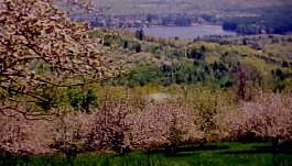
View of the pond from the apple orchard
The Brettun’s Pond Association (BPA) was formed in 1975 by a group of camp and land owners. The BPA’s goals at the time of the founding of the organization were to protect the quality of the pond, enhance the opportunities for a wide range of recreational activities, and establish a group of citizens that would act in a role of stewardship for the pond. The charter for the BPA included the formation of several committees and a Board of Directors.
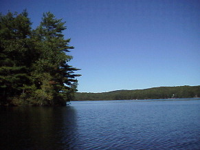
Brettun’s Pond is located in the Town of Livermore, Maine, at the intersection of Route 4 and Route 108. The pond covers approximately 165 acres. Water depths measured in the pond show that the average depth is approximately fifteen feet, with the deepest spots measuring almost 50 feet. The pond is fed by several springs and two streams.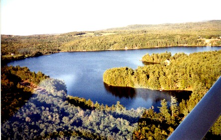
Special thanks to Bill Brown for taking the photographer aloft!
The BPA has a team of officers that were elected at the last annual meeting (the most recent annual meeting was held on August 22, 2023 at the Brettun’s School Building). The officers for 2023 are:
| TITLE | NAME |
| President | Brett Deyling |
| Vice-President | Churchill Barton |
| Secretary | Amanda Barton |
| Treasurer | Kathy Castonguay |
Fishing – Brettun’s Pond is known to hold smallmouth bass, brown trout, brook trout, hornpout, perch, and pickerel. Trolling, casting artificial lures, flyfishing, and bait fishing are all popular on the pond. Ice fishing season begins January 1st each year. Open water fishing begins on April 1, if you can find open water. Check the Maine Department of Inland Fisheries and Wildlife’s web site for info on fishing regulations and seasons.
Boating – At 165 acres, more or less, Brettun’s is suitable to most trailerable watercraft. Boats often seen on the pond range from canoes to ski boats, and there are several wind-powered craft out on the pond when the weather is favorable. You can read about Maine’s boating laws online at the Maine Department of Inland Fisheries and Wildlife’s Boating site.
Boat Launch – Brettun’s Pond has a public boat ramp located on Route 4 near the pond’s outlet. There is no dock, and the ramp is best suited to small craft. The bottom is sandy, but very shallow.
Public Beach – A small public beach is located on Route 4 at the boat ramp area. Visitors should remember to remove all litter when you leave, please! The public beach offers good swimming and a nice view of the pond.
Water Quality – Testing of pond water has been performed in past years, and the results have been impressive. How is the water quality today? The Water Quality Committee is working to build a database of current data. Read on…
Water Quality Committee – In 1998 the BPA formed a Water Quality Committee as a means of formalizing the Association’s efforts to monitor water quality and find ways to protect the pond from storm water runoff and improper development practices. The WQC also has entered the pond into the State of Maine’s Volunteer Lake Monitoring Program. Members of the WQC attended training classes for VLMP activities and are now collecting secchi disk readings to learn more about the pond’s water clarity. You can see the results of this bi-weekly testing by clicking here.
Watershed Survey – The BPA has completed a Watershed Survey, looking for areas where erosion is causing sediment to wash into the pond. A series of public meetings was held, and a final report was published. BPA also completed a Watershed Management Plan, which identified potential remedies to the problem areas that were identified during the Survey. Next step is to fix the problems identified in the survey and management plans.
ARE YOU A MEMBER OF THE BRETTUN’S POND ASSOCIATION?
WANT TO GET YOUR NEWSLETTERS BY E-MAIL?
(Saves postage costs and paper)
Any questions about this website? Contact us!
brettunspond@gmail.com
Special thanks to Dennis Mancini for collecting clarity data for the last several years.
See a graph of Brettun’s Pond Water Clarity readings in Adobe pdf format by clicking here